
5,000-Year-Old Fortress Discovered in Romanian Forests with LiDAR Technology
Deep within the dense forests of Romania’s Neamț region, archaeologists have uncovered the remnants of a 5,000-year-old fortress with the aid of LiDAR technology. This significant discovery has brought to light the intricate details of the ancient structure, which dates back to the transition period from the Neolithic to the Bronze Age.
LiDAR Technology Enabled Detailed Mapping
LiDAR (Light Detection and Ranging) technology is a method that measures distances using laser pulses and creates high-resolution models of terrain. The use of this technology allowed researchers to create a detailed map of the fortress hidden beneath the dense forest cover. Archaeologist Vasile Diaconu, who participated in the study, stated that the LiDAR scans provided a clear image of the approximately 5,000-year-old structure and revealed details that were not observable on-site due to the dense vegetation.
A Fortress of Strategic Importance
Research conducted using LiDAR-equipped drones revealed that the fortress had defensive features such as large ditches and earth mounds. These structures enhanced the defensive capabilities of the fortress and suggested that it was a strategically important site. The fortress’s location on a high elevation may have provided its inhabitants with the advantage of detecting approaching threats by offering a perfect view of the surrounding landscape.
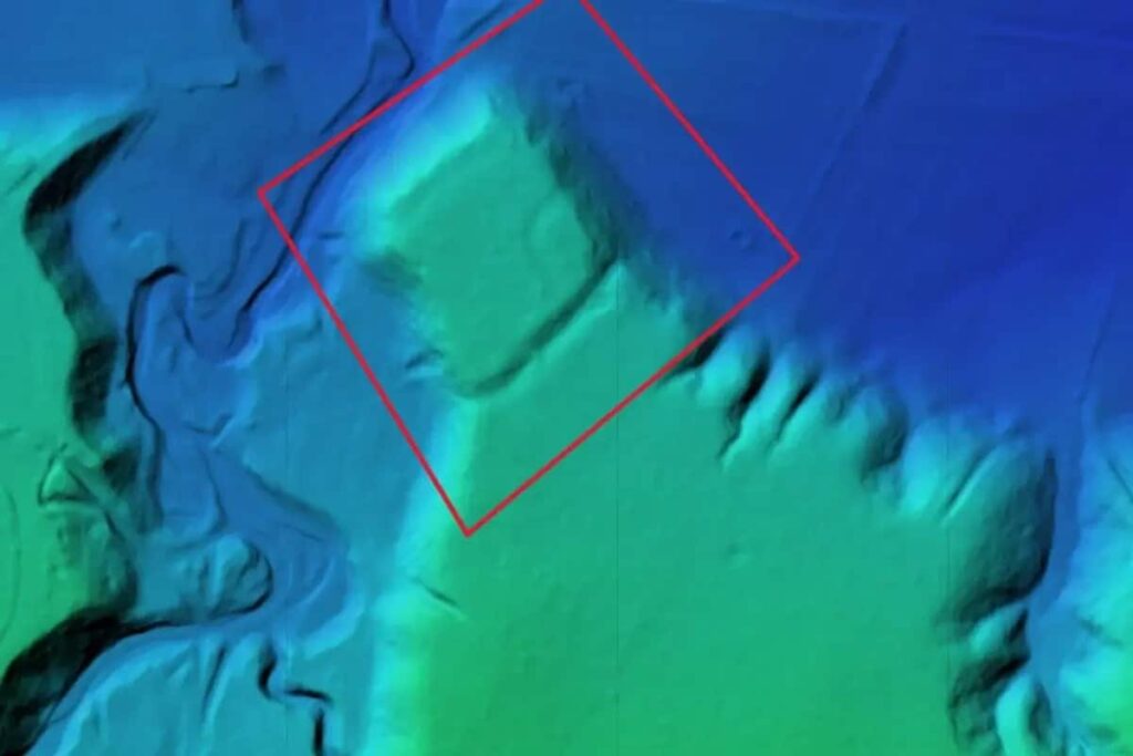
This discovery highlights the increasing role of technology in archaeology. LiDAR is a particularly valuable tool because it allows archaeologists to map large, inaccessible areas without disturbing the ground or relics. Vasile Diaconu emphasized the importance of these technologies, stating, “We can only better understand the complexity of archaeological sites by using modern technologies.”
Teacher and Student Collaboration
According to Daily Galaxy, this archaeological project also holds personal significance for Vasile Diaconu. The study was the result of a collaboration between Diaconu and his former student, Vlad Dulgheriu. Dulgheriu, who owns Geocad Services, a company that makes the use of LiDAR technology possible, became involved in this project due to his interest in his mentor’s work. Diaconu expressed his pride in his former student’s achievements.
This discovery once again demonstrates how valuable modern technologies like LiDAR are in archaeological research. Thanks to these technologies, it becomes possible to unravel the mysteries of the past and gain new insights into ancient civilizations.
The project was carried out in collaboration with Geocad Services, Geo Edu Lab and the National Institute for Research and Development for Earth Physics.
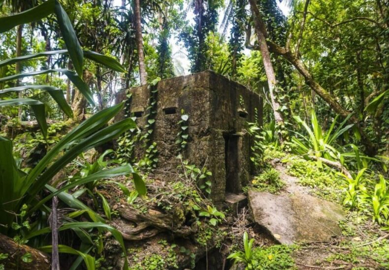
Cover Photo: MageBROKER/Michael Runkel
- A 1700-year-old statue of Pan unearthed during the excavations at Polyeuktos in İstanbul

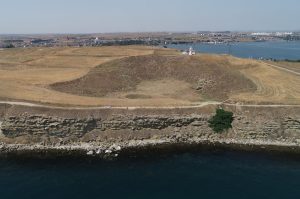
- The granary was found in the ancient city of Sebaste, founded by the first Roman emperor Augustus

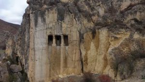
- Donalar Kale Kapı Rock Tomb or Donalar Rock Tomb

- Theater emerges as works continue in ancient city of Perinthos

- Urartian King Argishti’s bronze shield revealed the name of an unknown country
- The religious center of Lycia, the ancient city of Letoon
- Who were the Luwians?
- A new study brings a fresh perspective on the Anatolian origin of the Indo-European languages
- Perhaps the oldest thermal treatment center in the world, which has been in continuous use for 2000 years -Basilica Therma Roman Bath or King’s Daughter-

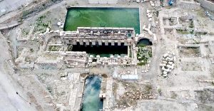
- The largest synagogue of the ancient world, located in the ancient city of Sardis, is being restored


Leave a Reply